

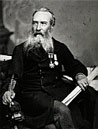
Alexander Murray was born in Crieff, Scotland, the son of Anthony and Helen (Fletcher-Bower) Murray. He worked in Britain and Canada, before coming to Newfoundland in 1864 to become the first director of the Geological Survey. His first major task was to produce a reliable topographical map of the interior of the island. Murray did detailed work in the are between Hall’s Bay and St. George’s Bay, as well as the area surrounding Conception, Placentia and St. Mary’s Bays. He also mapped parts of the Great Northern Peninsula and central Newfoundland. From 1868 he was assisted by James P. Howley.
In an attempt to increase the rate of settlement in wilderness areas, Murray proposed, in 1874, to introduce a township survey. His plan was to subdivide the land in the drainage basins of the Gander and Exploits Rivers, into six-mile square blocks. This, he thought, would provide the land owners with a more secure tenure for development. He also proposed the designation for specific areas for possible timber, agricultural or mineral use.
Murray produced the first geological map of Newfoundland and his reports of rich resources in the island’s interior were an important factor in the decision to build the trans-island railway in 1881.
Poor health caused him to return to Scotland in 1883. He was succeeded as director of the Geological Survey by Howley.
Source: Encyclopedia of Newfoundland and Labrador, 1995