Date: September 21-22, 2010
Location: eastern Newfoundland
Easting:
Northing:
Latitude:
Longitude:
Fatalities: 1
Injuries: 0
Source: CBC website, news reports, CBC TV, The Telegram
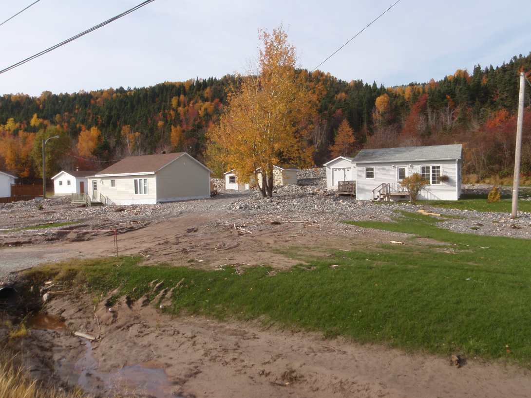
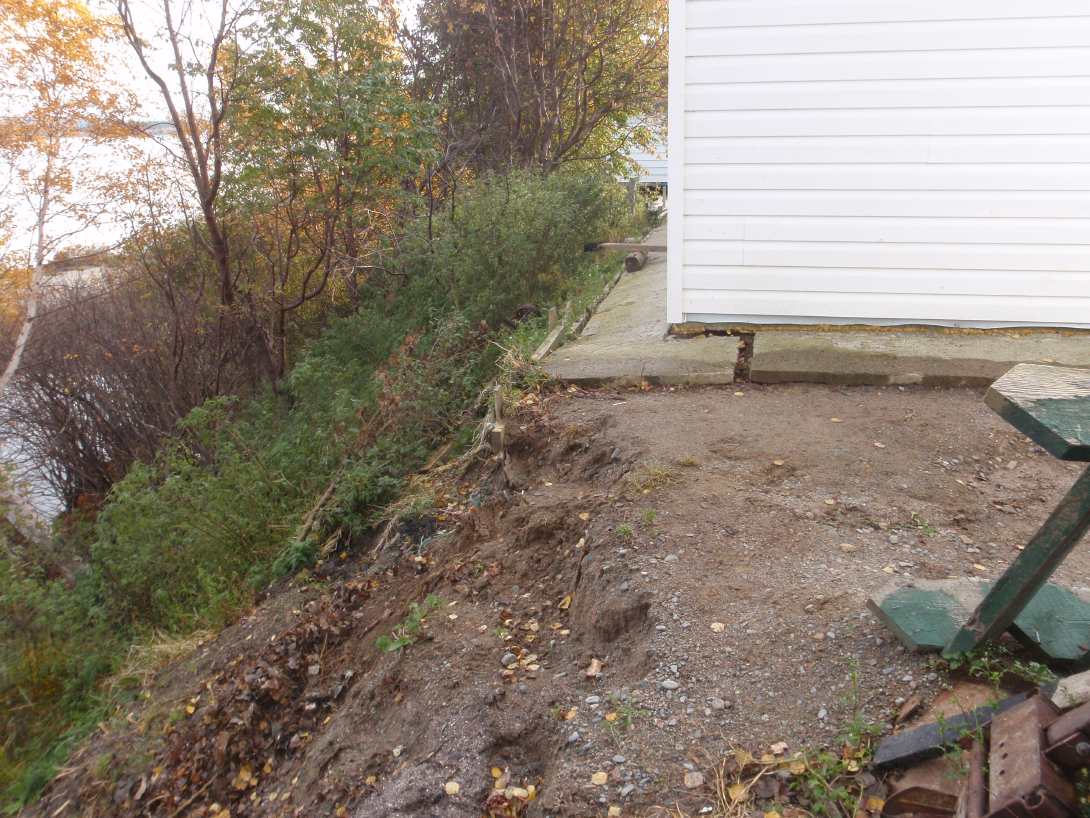
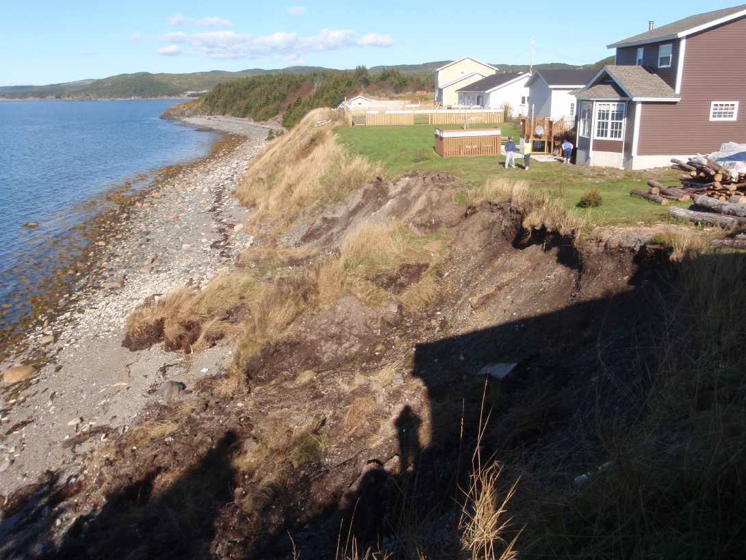
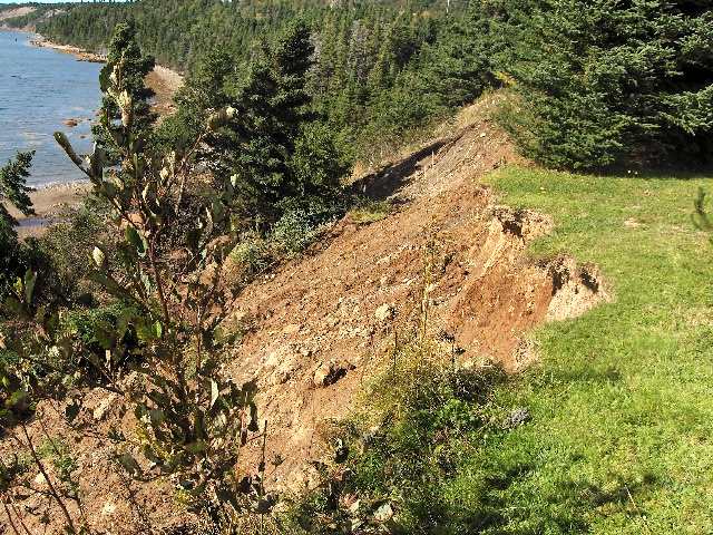
Significant flooding and several landslides occurred on September 21/22, 2010 during Hurricane Igor. This was a Level 1 hurricane that tracked along the eastern edge of the Avalon Peninsula, and which combined with an associated low-pressure system that passed through Newfoundland at the same time, brought maximum rainfall amounts of 236.2 mm (St. Lawrence), and maximum wind gusts of 172 km/hr (at Cape Race). Damage from flooding occurred throughout eastern Newfoundland, including the Burin, Bonavista and Avalon peninsulas. Numerous roads were washed out, bridges destroyed or damaged, and residences inundated. The Trans Canada highway was closed for several days due to a washout in Terra Nova National Park. There was one fatality, near Britannia on Random Island when a road collapsed and an onlooker was swept into the adjacent river.
Several small landslides occurred during the hurricane, at Elliott’s Cove and Britannia on Random Island, Long Beach near Clarenville, Southern Harbour, Gambo and Marystown. None resulted in the evacuation of adjacent property.
Repairs from the effects of the storm were expected to take several years, with costs likely in excess of $100 million.