Date: June 13, 2009
Location: Trout River
Easting:
Northing:
Latitude:
Longitude:
Fatalities: 0
Injuries: 0
Source: Reports from Department of Municipal Affairs, direct observation, CBC news reports
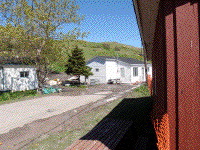
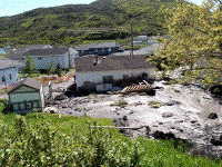
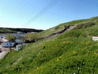
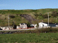
One week after a landslide took place at Trout River, a second, more serious landslide struck one house in the early morning and moved it off its foundations across the road.
The landslide took place at exactly the same location as the previous event (Herb Street), with apparently a second failure at the headwall of the previous landslide. There had been close to 40 mm of rain in the previous 24 hours. Five houses in the area remained empty after being evacuated following the previous landslide. Mr Butler was digging a ditch around his house to try and divert water away from it when the landslide occurred. He was able to escape the area before the landslide struck the rear of his house, pushing it approximately 5 m off its foundations and into the street.
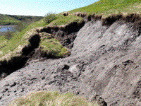
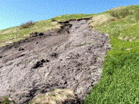
The landslide likely occurred through rotational failure, followed by liquefaction. Mud flowed over the lower slope, leaving grass intact. The material involved was interbedded glaciomarine sands, slits and clay, with clay the dominant component. Examination of slope morphology in the area suggested a history of former landslides.
Residents recalled previous landslides in the area, one of which apparently struck a barn and killed three sheep. The slope formerly had a number of wells in it, and was known as a source of springs.
The town declared a state of emergency, and houses remained evacuated, with a further house in the path of the landslide added to the original five houses. Although the landslide did not strike the other houses in the immediate area, residents suggested that they had moved slightly.
Even after the second landslide large tension cracks remained adjacent to the landslide scar, and a small amount of material fell 10 days later after further rain.