
Archaeology in Newfoundland and Labrador 1997
Edited by K. Nelmes
Report of an Historic Resources Evaluation: Goose Bay to East of Churchill Falls
Roy Skanes
Background
Project Area:
The Policy and Planning Division of the Department of Works, Services and Transportation (Government of Newfoundland and Labrador) is currently in the process of upgrading four sections of the Trans Labrador Highway between Goose Bay and east of Churchill Falls (Figure 1). Included are:
- approximately 22 km between Goose Bay and Lower Brook,
- approximately 38 km between Upper Brook and Popes Hill;
- approximately 28 km between Popes Hill and Bob’s Brook; and
- approximately 40 km between Bob’s Brook and Cache River. [1]
While the majority of upgrading is confined to the existing right-of-way and consists primarily of raising the grade by 1 m with quarried rock, and limited grubbing on either side to establish a consistent 30 m wide corridor, there are, however, a number of locations where sharp curves will be eliminated and entirely new road constructed. Between Goose Bay and Lower Brook, for example, there will be approximately 6.3 km of new road, between Upper Brook and Popes Hill, approximately 9.5 km, between Popes Hill and Bob’s Brook approximately 4.5 km, and between Bob’s Brook and Cache River approximately 19 km.

Figure 1. Trans Labrador Highway Study Area Location Map.
Study Rationale and Objectives:
Because construction and upgrading of the road could result in impact to historic resources, the Department of Works Services and Transportation committed to having an Evaluation conducted of all locations where ground disturbance would occur. This included not only points between Goose Bay and Cache River where the highway will be widened and straightened, but also a number of existing gravel pit and rock quarry sites, and the terrain in the immediate vicinity of bridges at East Wilson River, Wilson River, Metchin River, and West Metchin River. The primary purpose of the project was to: a) evaluate the historic resources potential or sensitivity within the identified areas; and b) recommend the appropriate methodology and scope for further detailed impact studies and/or mitigation if indicated.
It is important it be clarified that the scope of work for this particular project was not that of a Stage 1 Historic Resources Impact Assessment (HRIA) wherein extensive background research, a comprehensive field survey and production of a detailed overview report would be the standard requirements. Rather, the purpose was to evaluate through visual inspection (and supplementary test-pitting, if necessary) each zone where disturbance would, or already had occurred, in order to determine the degree of potential for historic resources and whether or not further inquiry (i.e. a full Stage 1 HRIA) was warranted. The decision to adopt this strategy as opposed to adhering to the Visiting Newfoundland and Labradorlines set out for a standard impact assessment was based on the awareness that: a) because the road was already largely in place, any historic resources within the right-of-way corridor would likely have been destroyed in the early 1970s during the initial construction; and b) the topography in areas where widening and straightening would take place did not appear particularly attractive for human occupation.
Methodology
The total extent of the project area, including the combined length of the four highway sectors as outlined above was approximately 128 km. As a result, it was not possible in the allocated time frame to test the entire route as well as the terrain in the immediate vicinity of existing gravel and rock extraction sites, and the four bridges to the west of Cache River. Consequently, emphasis was placed on walking the proposed road-diversions that could not be evaluated from the highway, and testing any areas adjacent to the existing route that appeared to have potential for historic resources and would be disturbed by road widening and/or materials extraction. In areas of particular potential, such as at river crossings, on level, well-drained terraces adjacent to water, and at locations of importance identified by informants, more intensive investigation was carried out. In addition to test-pitting, this involved, for example, an examination of eroding banks, tree falls, and any areas where the subsoil had been exposed as a result of natural and/or cultural processes.
Over the course of the Evaluation, a photographic record of the project area was compiled, and all locations of interest plotted on 1:50,000 scale topographic maps. Moreover, discussions were held with site workers to acquire essential land-use data and knowledge regarding the presence of any known archaeological sites and/or materials in or from the area.
Survey Results
Between Goose Bay And Lower Brook:
Between Goose Bay and Lower Brook, four sections of highway where widening had occurred (Areas A-D), a number of existing materials extraction sites, and approximately 22 km of new road were evaluated for historic resources potential. Upgrading activities in all areas involved brush clearing and grubbing, which at the time of field work had been largely completed (Figure 2). Within Area A, two short diversions adjacent to the existing route were under construction, and Areas B, C and D, each had one diversion of less than 200 m in length. At the time of the survey, the majority of vegetation had been removed from the entire route and the surface partially grubbed. Consequently, substantial ground disturbance had already taken place.
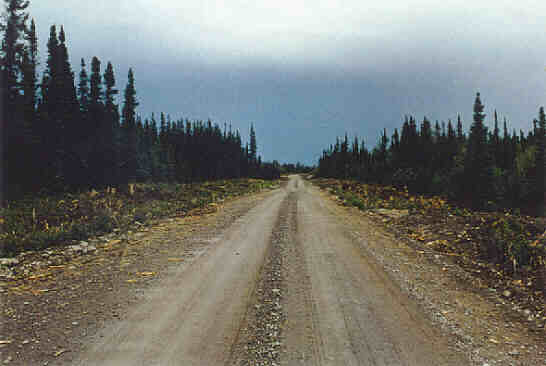
Figure 2. Typical Road Widening, Goose Bay to Lower Brook.
The evaluation indicated that the historic resources potential in all areas was low. This conclusion was based on the fact that the terrain is extremely hummocky, densely forested, and in several areas, boggy (Figure 3). As a result, it seems unlikely it would have been considered attractive for human occupation.
In addition to the above, an investigation of the area adjacent to the bridge at Lower Brook revealed no materials of historic resources significance. It must be acknowledged that this area was severely disturbed by construction activities in the 1970s when the highway was initially built, and more recently, when the new bridge was erected.
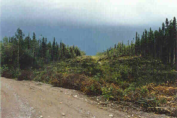
Figure 3. Road Diversion, Goose Bay to Lower Brook.
Between Upper Brook and Popes Hill:
Between Upper Brook and Popes Hill approximately 9.5 km of the Trans Labrador Highway were under construction. The right-of-way was being widened to meet the 30 m requirement, and a number of short diversions were necessary adjacent to the existing road. The required brush-clearing and grubbing for all construction activities had been completed prior to the Historic Resources Evaluation.
Investigation of the construction areas, as well as both sides of the route in general, revealed no materials of historic resources significance. It was noted, however, that at two locations along the highway there are remains of recent Innu camps, both of which appear to post-date initial construction of the road c. 1972.
Innu Camp 1 is situated approximately 2 km west of Edward’s Brook on a large, predominantly treeless, sandy terrace. The physical extent of the area is in the order of 1 km north-south by 0.5 km east-west, and it contains a large number of shallow depressions commonly referred to by geographers as “blow-outs.” The presence of these features, and the usual lack of vegetation in and around them, allowed a thorough investigation to be carried out. The average elevation of the camp is in the order of 60 m above sea level. Given the topographic conditions, the proximity to water and forest, it would appear that the area is generally well suited for human occupation. Unfortunately, however, a certain amount of construction-related disturbance had occurred along the northern edge of the site (Figure 4).
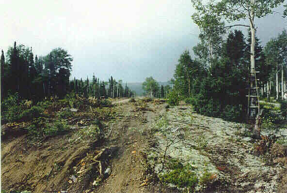
Figure 4. Ground Disturbance at Innu Camp West of Edward’s Brook.
At the western end of the terrace, on both the north and south sides of the road, the investigation revealed clusters of recent Innu stone hearths, wooden tree scaffolds and tent rings. By far the large majority of remains were situated on the south side of the road adjacent to a small cabin. Based on the nature and extent of the materials, it would appear that the site has been occupied on an intermittent basis for at least the last twenty years or so. Despite a thorough investigation, no evidence was identified to indicate an occupation prior to construction of the road.
Informant interviews conducted during and subsequent to the field study indicated that the sandy terrace west of Edward’s Brook had been used by Innu as a fall “gathering place” between c. 1979 and 1982. While one informant was not aware of Innu using the site prior to construction of the road, and did not know of anyone who had discovered materials to support such an occupation, he did state, however, that it may be used in future for the same purpose. A second informant claimed that he had heard from several individuals that the area was still used periodically by Innu, but was unaware of any pre-1970s artifacts from the site. A third party (the owner of the small cabin) stated that even though he was not aware of any physical evidence to support a pre-1970s Innu presence, he felt there was a possibility it could exist. This assertion was based on the assumption that the area was probably used prior to this century as part of a travel route from the coast to the interior. Unfortunately, the informant was unable to provide any evidence, either documentary, oral, or physical to support his belief. Nonetheless, the site’s proximity to the Churchill River, as well as the attractiveness of the topography, and the resource profile for this sector of Labrador could indicate that there is some substance to his claim.
Innu Camp 2 was situated adjacent to the Trans Labrador Highway, approximately 3.5 km west of Pinus River. This site, referred to as a “healing camp,” was apparently occupied during the winter of 1995 by as many as 15 Innu families. Remains at the site consist of a number of wooden tent frames, tree scaffolds and hearths, and on the south of the road, the shell of a wooden, dome-shaped sweat lodge (Figure 5). An examination of a number of blowouts at the site, as well as random test-pitting over the area, failed to identify any remains pre-dating the modern camp.
Investigation in the vicinity of the Pinus River Bridge also failed to locate any remains of historic resources significance. Similar to other bridge sites to the west of Goose Bay, the riverbank adjacent to the highway has been disturbed as a result of road construction and subsequent upgrading.
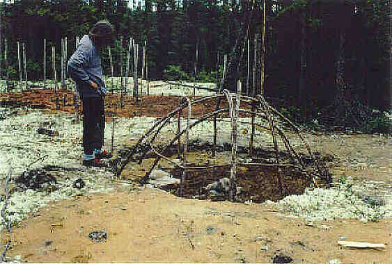
Figure 5. Innu Healing Camp West of Pinus River.
Between Popes Hill And Bob’s Brook:
Between Popes Hill and Bob’s Brook approximately 28 km of road were under construction at the time of the Evaluation. While the majority of work involved widening the existing right-of-way, there were a number of locations that required completely new road sections. At the time of the Historic Resources Evaluation, approximately 95% of the work had been completed. Other than the remains of an Innu camp a small gravel pit adjacent to the road at approximately 8 km east of Bob’s Brook, no cultural remains of significance were identified.
Between Bob’s Brook and Cache River:
The most westerly section of the Trans Labrador Highway evaluated is situated between Bob’s Brook and Cache River and spans a total distance of 40 km. As in more easterly sectors, upgrading here involved increasing the width of the road right-of-way to the 30 m standard, and construction of a number of short diversions. At the time of the Historic Resources Evaluation, the centre line had been cut for only the western half of the project area. Consequently, investigation was restricted to the accessible off-road sectors and areas directly adjacent to the highway where widening will occur.
The evaluation revealed that the western half of the most westerly project area would probably not have been attractive for human occupation. Generally, it is very hummocky, and in many areas, boggy. Other than the remains of a recent Innu camp, no materials of historic resources significance were identified. The camp is situated on the side of the road adjacent to a small river and consists of two tent frames, one in a gravel pit, the other just off to the side in a wooded area. Based on the location of the survey stakes, it would appear that the centre line of the new road will pass directly through the camp.
In all sectors evaluated, including locations where the road will be widened and straightened, at river crossings and in the vicinity of gravel pits, no significant historic resources, or the potential for such findings, were identified.
Bridge Sites:
Four bridge sites to the west of Cache River were investigated for the presence of historic resources and historic resources potential. Included were: East Wilson River; Wilson River; Metchin River; and West Metchin River. Despite a visual examination of these areas, no evidence of human usage pre-dating construction of the road was identified. It is important to note that due to the level of ground disturbance, if the shoreline in close proximity to the bridges had been used prior to road construction, evidence of such occupation would be virtually impossible to locate.
Conclusions
Over the course of the field study, approximately 128 km of road were investigated where upgrading is ongoing or will occur. So too were a number of existing rock and gravel extraction sites, and the terrain in the immediate vicinity of bridges at East Wilson River, Wilson River, Metchin River, and West Metchin River. Other than a number of modern Innu camps situated in gravel pits, or in clearings along the side of the road, no materials or sites pre-dating the early 1970s were discovered. This is thought to be due to the nature of the terrain which is generally unsuited for human occupation. In areas adjacent to small brooks and rivers, where one might consider the potential for cultural materials to be highest, disturbance from previous road and bridge construction would almost certainly have eradicated any physical evidence of occupation, if in fact it existed. Therefore, based on the overall findings of the evaluation, the historic resources potential for all areas would be considered low.
Note:
[1] Figure 1 indicates where the different Study Areas are located in relation to km 0 of the Trans Labrador Highway which is generally considered to be the Quebec/Labrador boundary.